Each of these 5 boxes will hold stamps for a covered bridge and
a secondary clue.
This is a 2 mile trail - round trip - but for those with limited
time to box, these will be on a 1/2 mile loop and you won't actually see the pond.
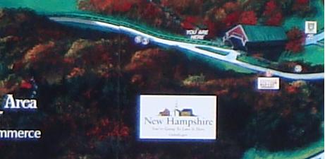
You don't have the 2009 Map & Guide from the Interval Vista??
Do you even know where North/South Rd is?? From Rt 16 turn right onto Artist Falls Rd and cross over N/S Rd. Continue
up to Thompson Rd and turn right again. Now look for the small parking lot for The Nature Conservancy.
N 44d 02'33" W 71d 06'48"
Bridge #1 - very near parking. As you
head in on the trail you will pass a path to a small clearing and then cross a babbling brook. Back at the path are
two large rocks. Standing there spot the other two rocks and that small cluster of little rocks - SPOR.
Continue to the information kiosk ahead but not in view just
yet. Follow trail sign (not that yellow thing on the tree) for Pudding Pond to the far right of kiosk.
Bridge #2 The Pudding Pond return loop bears
left at 0.3 miles . Continue straight for 18 steps and stop. Look to your right for the 4 trunk tree.
[2 are dead, so this clue may fall away in due time.] Continue a few steps more to use the deer (social?) trail to reach
the 4 trunk tree. Careful of the vegetation on this conservancy property.
Return the 18 steps back to the main trail and continue along it
(you are now going right away from the junction.)
Bridge #3
The trail will reach a "T" which is the start of the loopy part.
There is a wooden sign on a tree, but you have probably spotted the two yellow/green metal arrows pointing this way and that.
Follow this way . . . to the right. After a few steps look right into the woods. Do you see the large tree with
the big gash in its trunk? Keep lookin' till you do!! Just beyond is a deer trail. Ducking under the branches
follow it in no further than 10 steps and turn around. Off to your right will be a tree with a hole at its base - now
filled with pine cones. Please replace the pine cones and more to keep it filled.
Return to marked trail and continue 'this way'.
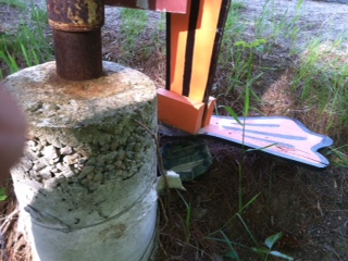
Bridge #4 is actually at a bridge!!
You will see a foot bridge and some signs one of which will point out that you have 0.4 back to the parking lot.
Go to the far end of the bridge and look down to your right.
There are several rocks and one is on top of the box just next to the metal rod support.
This is where we leave the Pond Loop Trail without catching sight
of the pond. Although if you are up to a pleasant walk of 2 miles go back and pick up the loop -- but you'll miss
Bridge #5. Actually you could make
the loop and then when you come back to the Yellow Green Arrows at the start of the loop just continue on around to the trail
spur opposite the large sitting log on the side of the trail. In any event you need to return to the unmarked spur trail
which is the first left heading back from the bridge.
The trail will narrow and then it will open up to a pine forest
with minimal undergrowth. Here is the biggest pine tree I have ever seen on the East Coast (maybe it isn't a pine
-- I couldn't see that far up.) After gawking look left for the natural tree bridge/tunnel -- about the size fairies
might walk thru. Approach from the back side to grab the box. Yep, I scavanged a piece of trail metal to keep
box from falling into the depths.
Continue on this unmarked spur trail keeping right at
the next two "Y" intersections. i.e. steer away from the housing.
At the end of the spur you will be back at the junction for Bridge
#2. And this is how I shortened the loop to 1/2 mile. I re-walked it in 30 min, so just add your time for pin
pointing the boxes and stamping in. I'd allow at least one hour to complete.